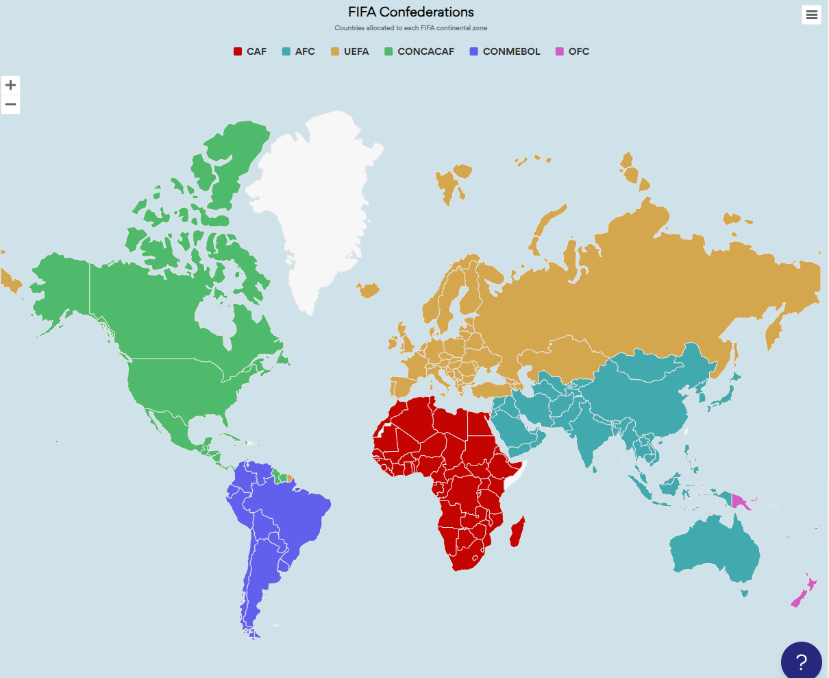
The “World Cup Host Nations (1930 – 2026) – Category map” is a captivating and informative interactive map that provides a visual representation of the countries that have had the honor of hosting the FIFA World Cup, spanning nearly a century of football history. This dynamic map allows users to explore and gain insights into the diverse locations that have played host to the world’s most prestigious football tournament.
Users can interact with this map to select different World Cup editions and display specific information about the host nation for each tournament. The map typically categorizes host countries by year, showcasing historical and current host nations. Users can click on each category to access details, including the number of matches played, stadiums used, and memorable moments from each World Cup.
This interactive map is a valuable resource for football enthusiasts, historians, and fans looking to trace the history of World Cup hosting and understand the global footprint of the tournament. It offers a unique opportunity to appreciate the cultural, logistical, and sporting significance of each host nation.
Whether you’re a student, journalist, or a devoted football fan, the “World Cup Host Nations (1930 – 2026) – Category map” provides an engaging way to explore the rich tapestry of World Cup history, fostering a deeper connection to the tournament’s global journey over the decades.